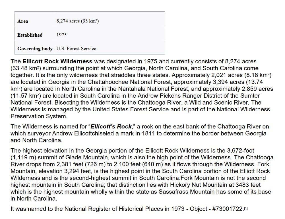
View of Whitesides Mountain (4,930’) having the highest sheer cliff East of the Mississippi River the view being free of man made structures.
Chattooga River/Ellicott Rock Wilderness Area/Blue Ridge Mountains Conservation Tract
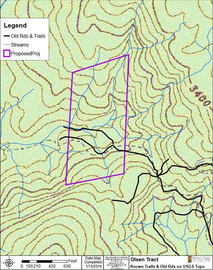
This property is a unique-sensitive thirty (30) acre tract having spectacular views. Additionally it’s an “in-holding” being completely surrounded on all borders by the US National Nantahala Forest owned land, “a private 30 acre island” within the National Forest being a short twenty minute drive to either Highlands or Cashiers, North Carolina. A deeded ingress/egress easement traverses USFS owned land.
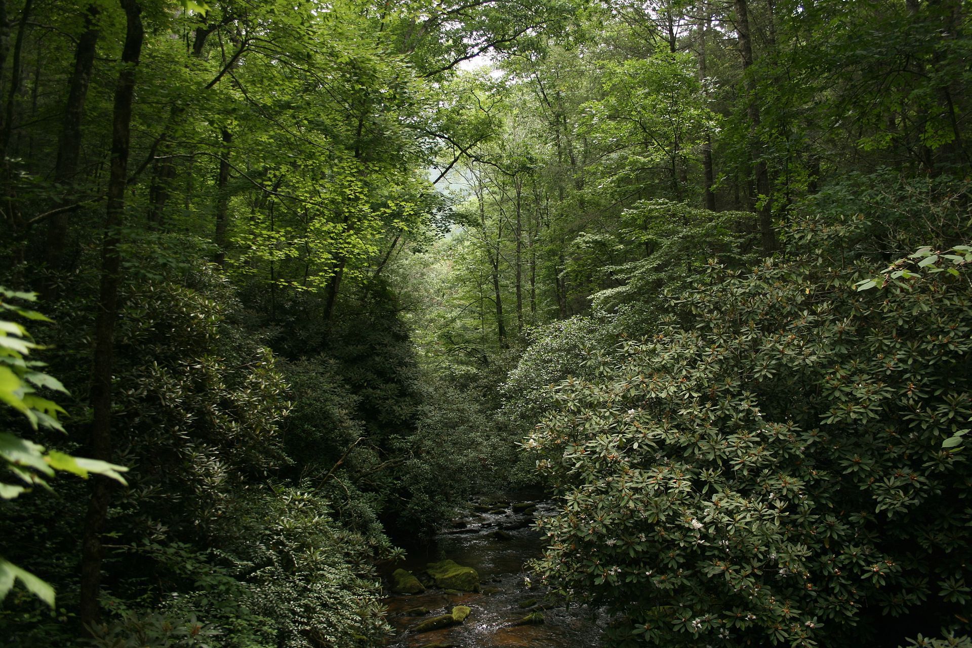
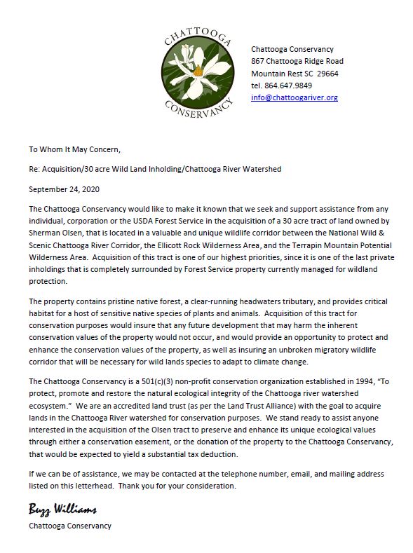
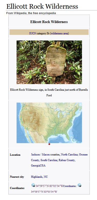
As noted in the enclosed letter copies Highlands-Cashiers Land Trust and Chattooga Conservancy desire this tract be preserved in whole or part in a natural or near natural state. Pristine streams flow through the tract their never having traversed privately owned land having originated on nearby Terrapin Mountain their being inhabited by native trout and the rare Chauga crayfish. The Chattooga River is nearby being a mile west of the easement entrance. In addition to the Ellicott Rock Wilderness Area the Chattooga River is a federally designated a Wild and Scenic River Corridor these two areas totaling in excess of 15,000 acres. Ellicott Rock was first identified-surveyed in 1811 by Andrew Ellicott as the sole common point of Georgia, North and South Carolina sharing a common corner.
In addition to retaining the all or a portion of the property in its natural state, a conservation purchaser could develop a natural Park to include hiking trails, a five acre pond, view corridor patios, stream waterfall areas along with the option of naming the Park in memoriam for a person of their choosing. Directional signage on major access roads is available with the USFS agreeing to include the Park’s chosen name being printed on future USFS area maps. There are few tracts being “islands” within National Forest owned lands with deeded access whiles being convenient to the upscale-beautiful Blue Ridge mountain summer home towns of Cashiers and Highlands, NC while their being just over a two hour drive from Atlanta.
The Ellicott Rock Wilderness Area is Northern Boundary is directly across from the US Forest Service Easement Entrance Road noted in shaded dark green. The shaded light green areas are lands of the US Nantahala National Forest thousands of acres. Referencing the heavy black horizontal line and vertical line which denotes the Chattooga River; Georgia is below and left of the river, South Carolina is below and right of the river, and North Carolina is above the horizontal line left to right.

Chattooga River
From Wikipedia, the free encyclopedia
This article is about the river forming the boundary between Georgia and South Carolina. For the river with the same name in western Georgia and eastern Alabama, see Chattooga River (Alabama– Georgia).
This article needs additional citations for verification. Please help improve this article by adding citations to reliable sources. Unsourced material may be challenged and removed. (May 2015) (Learn how and when to remove this template message)
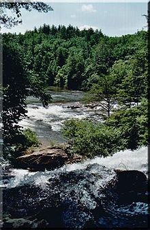
Chattooga River near Dick's Creek Falls
The Chattooga River (also spelled Chatooga, Chatuga, and Chautaga, variant name Guinekelokee River) is the main tributary of the Tugaloo River. Its headwaters are located southwest of Cashiers, North Carolina, and it stretches 57 miles (92 km)[1] to where it has its confluence with the Tallulah River within Lake Tugalo, held back by the Tugalo Dam. The Chattooga and the Tallulah combine to make the Tugaloo River starting at the outlet of Lake Tugalo. The Chattooga begins in southern Jackson County, North Carolina, then flows southwestward between northwestern Oconee County, South Carolina, and eastern Rabun County, Georgia. The "Chattooga" spelling was approved by the US Board on Geographic Names in 1897.[2]
The river was used as a setting for the fictional Cahulawassee River in the book and film Deliverance.
The Chattooga River flows into Tugalo Lake where it joins the Tallulah River. After flowing through Tugalo Dam the combined rivers become the Tugaloo River which, along with the Seneca River, becomes the Savannah River below Lake Hartwell. Downstream from that point, the water flows into the Atlantic Ocean near Savannah, Georgia.
The Chattooga River serves as part of the boundary between Georgia and South Carolina near latitude 35°N. The Chattooga River was not the original boundary line between South Carolina and Georgia. A treaty of 1816 extended the South Carolina boundary to its current location. Prior to 1816, the Chattooga was on the lands of the Cherokee Indian Nation.
The Blue Ridge Mountains, where the Chattooga starts, are considered to be ancient, even by geological standards. The rock is mostly granite. Geologists believe that the Chattooga may have made one direction change during its life. Originally, it probably flowed southwesterly into the Chattahoochee riverbed and on to the Gulf of Mexico, but at some point, the Savannah River eroded its northern headland until it intersected the Chattooga and diverted it to the Atlantic.
The rocks in the riverbed probably fell from the ridge above, but those rocks do not necessarily remain where they fall. In times of great downpours, high water, and fast currents, rocks can become dislodged and move downstream, taking other rocks and debris with them. During Hurricane Ivan in 2004, the wind force and waters knocked down big boulders off the sides. The hurricane released enough water in the Chattooga watershed to bring the river to its highest recorded flow rate, around 26,000 cu ft/s (740 m3/s) to 28,000 cu ft/s (790 m3/s), rivaling the typical flow of the Grand Canyon.
Since May 10, 1974, the Chattooga River has been protected along a 15,432-acre (6,245 ha) corridor as a national Wild and Scenic River. 39.8 miles (64.1 km) of the river have been designated “wild”, about 2.5 miles (4.0 km) “scenic”, and 14.6 miles (23.5 km) “recreational” for a total of about 57 miles (92 km). On the commercially rafted sections (III and IV) there is a 1/4 mile protected corridor of National Forest on both sides of the river, allowing no roads to the river or development of any kind. There are a few areas on the river where access has been made more accessible on Section III, but much of Section IV is fairly remote. The Chattooga also bisects the Ellicott Rock Wilderness which straddles three states (Georgia, North Carolina and South Carolina) BFGO512and three National Forests (the Chattahoochee, Nantahala and Sumter National Forests). Much of the Georgia portion of the river is within the Chattooga River Ranger District of the Chattahoochee National Forest.
Known as the "Crown Jewel" of the southeast, the Chattooga was the first river east of the Mississippi to be granted the Wild & Scenic designation, and is still the only one that is commercially rafted.
Headwaters of the East Fork
The river is split into three forks. The Chattooga River is the main fork, running along the state line. The East Fork Chattooga River(sometimes East Prong Chattooga River) runs in from Jackson County, North Carolina and then Oconee County, South Carolina, and is 7.4 miles (11.9 km) long.[1] The West Fork Chattooga River (variant name Gumekoloke Creek) runs 6.0 miles (9.7 km)[1] in from Rabun County, Georgia, and is also a variant name for that county's Holcomb Creek, one of its own tributaries.
One of the largest tributaries in the Chattooga basin that flows mainly through private lands is Stekoa Creek, which flows primarily southeast for approximately 18 miles (29 km)[1] from its headwaters in Mountain City, Georgia, through Clayton, Georgia, to its mouth at the Chattooga River. The Stekoa Creek Basin is approximately 45 square miles (120 km2) in size.
Whitewater rafting
In the late spring, the river is lined with blooming pink and white mountain laurel. Early spring is also a great time to go rafting, kayaking, or canoeing because of the higher flows and cooler temperatures. The Chattooga is a free-flowing river (no upstream dam to control the flow) which quickly responds to rainfall or drought conditions. As a drop-pool style river, rapids are followed by calm pools for swimming.
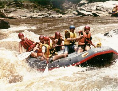
The Chattooga headwaters start near Cashiers as a small stream, but Green Creek is the start of the boatable section. Section I is the West Fork and is ideal for tubing and class II float trips.[3] Section II starting at Highway 28 is a class II float.[4] Section III has Class II-IV rapids which rafters and kayakers frequent. The final rapid in Section III is Bull Sluice.[5] Section IV includes Class II-V rapids, including the famous Five Falls (five class III-V rapids in roughly a 1/4 mile stretch).[6] The minimum age requirement to raft Section III is 8, and Section IV is 12. A number of signature rapids on this river were featured in the motion picture Deliverance.
The Forest Plan, issued in 1976 and revised in January 2004, restricted motorized craft, closed many roads to the river and prohibited floating on the upper 21 miles (34 km) of river. This plan was challenged by several boating advocacy groups, causing the United States Forest Service to withdraw the plan of 2004 and ordering a Visitor Use Capacity Analysis.[7] The USFS issued its final decision in January 2012.[8] The decision expanded boating onto some sections of the upper Chattooga with a number of restrictions based on season, section of river, property ownership, time of day, and water level. The decision has proved controversial due to the extensive amount of deaths of the river. Most of the fatalities occur from accidental blunt trauma from paddle oars. Boating remains illegal above Greens Creek and Below Licklog creek. This section is difficult, flows infrequently, and will likely see limited whitewater use.
Wednesday, 10 January 2018 16:35
Whiteside Mountain is both spectacular and interesting
Written by George Ellison
Looking for a place to make a weekend jaunt for a little hiking and lots of breathtaking scenery? Consider the Whiteside Mountain region between Highlands and Cashiers.
Whiteside Mountain, situated between Highlands and Cashiers alongside U.S. 64, is one of the most striking landmarks in the southern Blue Ridge province. It rises 2,100-feet from the valley floor to its summit at 4,930-feet along the eastern continental divide. The headwater feeder systems for rivers like the Cullasaja on one side of this massive granite outcrop eventually flow into the Mississippi and Gulf of Mexico, while waters on the opposite side flow into the Savannah and on to the Atlantic.
Retired Western Carolina University biologist Jim Horton, in his chapter on the natural aspects of the region in The History of Jackson County (1987), describes the mountain as follows: “Whiteside Mountain is a ‘pluton;’ that is, it originated as a molten intrusion probably far below what was then the surface. Its rock is Devonian in age, about 390 million years old. The fact that it is now so nearly exposed bears witness to the power of erosion, which has all but washed away the soil and softer rocks which once covered it.”
Clemson University biologist Robert Zahner, a longtime Highlands resident, wrote the definitive study of the mountain. In TheMountain at the End of the Trail: A History of Whiteside Mountain (1994). He notes that the Whiteside pluton is technically not a single mountain about one mile in length but a “massif” extending about four miles; that is, it “includes the Devil’s Courthouse on the northwest and Wildcat Ridge on the southwest (while) the width of the massif averages only about one-half mile.” And he also notes that the south-facing cliffs are more dramatic in regard to vertical relief because the “mechanical weathering of rock is greater on the sunny side.”
Such a prominent feature of the landscape naturally attracted the attention of the early Cherokee, who called it “Unaka”—their word for white. They associated various legends with its cliffs, caves, and pinnacles. It is thought to have been an early crossroads for Indian trails that crisscrossed the mountain region. The Cherokees built their villages in river bottoms for agricultural reasons. But they no doubt frequented Whiteside while traveling and hunting. Some have even asserted that Hernando de DeSoto and his men crossed over the mountain in the 16th century, leaving a mysterious inscription. A North Carolina state roadside marker in Highlands officially commemorates his travels “as the first tourist” (just kidding) in 1540. That improbable notion has been thoroughly debunked by T.W. Reynolds, who in his book The Southern Appalachian Region (1966) established that the “Spanish” inscription was perpetrated as a hoax by a local Highlands youth between 1925 and 1930.
Winter is an especially good time to visit the region since views are not impeded by foliage and traffic on the backroads is not great. The panoramic view down into the Chattooga River valley and into Georgia and South Carolina is —to use an overused description that is nevertheless apt —“breathtaking.”
Farther east on U.S. 64 towards Cashiers, there are clear views of the Devil’s Courthouse area. These shaded, north-facing cliffs are dark in appearance because they are covered with mosses and lichens that thrive is such a cool, moist environment. The springs and small creeks gathering in this section form the utmost headwaters of the Chattooga.
This is the upper Chattooga region, a world apart from the macho, river-riding realm of the lower South Carolina portion of the Chattooga depicted in the 1970s movie “Deliverance” based on James Dickey’s novel. The Chattooga here is at first a meandering valley stream that becomes, as it approaches the state line, a brawling, rock-strewn watercourse passing through rugged gorges.
Editor’s note:
This Back Then column by George Ellison first appeared in the Jan. 16, 2002, edition of The Smoky Mountain News

